trout
Member
Beatty, Nevada Moto Trip - March 2010
Why Beatty:
Thoughts of a Moto trip started brewing way back in September last fall when an email went out saying we just had to do a moto trip during Spring Break as he had 2 weeks off. Problem is most of the back country in BC or pretty much anywhere in the Pacific Northwest is still mostly under snow in March. We started thinking about heading south for a road trip. A short time later Pete was flying over the Death Valley area a few hundred kms northwest of Vegas. He could clearly see piles of roads all over the desert floor. Some of these were dead straight (probably put in for mining access), and lots of other twisty-turny little roads that followed canyons way up into the hills and beyond into other valleys.
TopoMap USA confirmed there were many back roads in this area. A spring trip started to hatch, time to fill in the blanks... A quick Google search left a lot to be desired in places to stay around this area with Death Valley being quite expensive and limiting, other options not available but research kept me coming back to a little town just outside Death Valley on the east side, just across the border into Nevada. It was game on.
Many hours checking out Google and working on TopoMap and 5 or 6 GPS routes were built in varying distances from 100 kms or so to over 300. These routes would take us into some very diverse areas and riding conditions. Also, riding around this area would have us going from almost 300 feet below sea level to over 6300 feet. EFI is going to be nice.
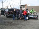
Starting off in Seattle - more to follow
Why Beatty:
Thoughts of a Moto trip started brewing way back in September last fall when an email went out saying we just had to do a moto trip during Spring Break as he had 2 weeks off. Problem is most of the back country in BC or pretty much anywhere in the Pacific Northwest is still mostly under snow in March. We started thinking about heading south for a road trip. A short time later Pete was flying over the Death Valley area a few hundred kms northwest of Vegas. He could clearly see piles of roads all over the desert floor. Some of these were dead straight (probably put in for mining access), and lots of other twisty-turny little roads that followed canyons way up into the hills and beyond into other valleys.
TopoMap USA confirmed there were many back roads in this area. A spring trip started to hatch, time to fill in the blanks... A quick Google search left a lot to be desired in places to stay around this area with Death Valley being quite expensive and limiting, other options not available but research kept me coming back to a little town just outside Death Valley on the east side, just across the border into Nevada. It was game on.
Many hours checking out Google and working on TopoMap and 5 or 6 GPS routes were built in varying distances from 100 kms or so to over 300. These routes would take us into some very diverse areas and riding conditions. Also, riding around this area would have us going from almost 300 feet below sea level to over 6300 feet. EFI is going to be nice.
Starting off in Seattle - more to follow