

Bushpig Performance
Member
Went on a great loop last week-end! If you like a fun and challenging route with very little people, it's great one!
GPS track with waypoints and route comments available, let me know and I'll share a Gaia folder with the data.
The idea for the trip came from wanting to go camping in a not so crowded spots as the popular rec site East of the Coqu.
So I look into the triangle made by Hwy 1 and 5, between Hope and Merrit.
Cabin Lake seems to be a good final destination, high in the alpine and a difficult access to.
As I was plotting the route, I realized that the regular access is coming from the North, going south west of Merritt.
So following along well established FSR to get close to the area I realized there might be a trail (which I call "ATV connector" further on)
connecting the 2 ends of decommissioned FSR making the access from the South possible. This was the main unknown before setting on the journey. All turned out to work out well without major difficulties.
Even if the total distance is not that impressive , keep in mind that there is slow going sections and more obstacles (tree down) possible as time goes.
In true dual-sport fashion leaving from home in Vancouver, off-road loop between Hwi 1 and 5 and back home.
It's about 630km with 270km off pavement (tarmac riding was strictly to leave the city and come back on the highway)
Friday evening was about getting out of town and camp early on Harrison East FSR (camp location included with track)
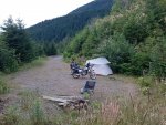
Day1: Harrison East, Kookipi, Uztlius, Spius and more decommissioned roads toward Cabin Lake
The part of the day was pleasing but we took quite the shower in the morning reaching Kookipi pass, made a stop at Shovel falls to let some clouds pass and refil drinking water. The falls were quite high with no sand bancks visible this time!
Then rode down toward Nahatlatch and Boston. This is the last time you can fill up before the end in Hope.
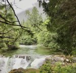
Then Uztlius and Spius FSR were really pleasant to ride, in the process of being re-graded, the beginning is a nice winding road going up and follow the creek of the same name. Then we took off for a less ridden part toward Spius, still fairly smooth with a sandy top making grip and slide a fun part of it!
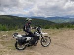
We had goal to camp at Cabin lake, our furthest location on the trip but we took the rain again mid afternoon, and starting to be at some elevation (around the 1200m), we were getting cold so we stop around 4pm at a rather abandoned rec site called Silver Lake.

Getting the tarp up was a real life saver along with the ability to make fire with wet wood, we begun the process of drying (or rather getting smoked!) ourself and as much as possible our gear!
Some clearing happened in the evening but it rained hard again overnight before showing a most promising Sunday!
Day 2: ATV connector, Cabin Lake and maling it back to Coquihalla summit
As soon as we left camp we realize it was a good decision to stop early as the rest of the route was the most challenging part.
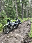
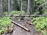
We got into the "ATV connector" which was the real unknown when planning the route, turns out it's still a double track, of course well soaked and muddy but easely rideable until we encounter some timber down, partially cleared by 4x4's or new falls had happen afterward but blocking us.
We finally found a way to go around in the bush not without difficulty moving some logs so our 2 bushpig could make it simply rolling and not hopping over any large logs! Followed a few steeper section but rather rocky than muddy, a bit challenging with a loaded bike but nothing any good rider can't managed on any bike.
After riding through about a kilometer or 2 of seriuosly overgrown FSR, meaning branches slapping your helmet (and beeping the horn to scare away any potential bear!), we finally met with the main road going up Cabin Lake.
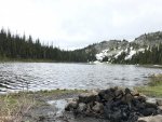
From then you could tell the landscape was transitioning into the alpine and we discovered the small lake tucked at 1800m. Some traces of snow left on the banks and a single family camping there. It was 5C at 10:30AM....brrrrr
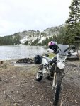
After a quick snack we headed our way down toward Spius FSR and linking with Maka murray FSR.
Lots a game we saw, deers, jack rabbit and grouse but the most memorable was a grizzli just crossing our path on the link between Spius and Maka Murray!
What a sight!
Exit was done at Murray lake/Juliet Dr to get onto Hwy5.
Fuel in Hope, pressure washed the bikes and we headed home on a not fun tarmac ride with many stop-go from weekenders heading back in town.

An the video now:
<iframe width="560" height="315" src="
" frameborder="0" allow="accelerometer; autoplay; encrypted-media; gyroscope; picture-in-picture" allowfullscreen></iframe>
GPS track with waypoints and route comments available, let me know and I'll share a Gaia folder with the data.
The idea for the trip came from wanting to go camping in a not so crowded spots as the popular rec site East of the Coqu.
So I look into the triangle made by Hwy 1 and 5, between Hope and Merrit.
Cabin Lake seems to be a good final destination, high in the alpine and a difficult access to.
As I was plotting the route, I realized that the regular access is coming from the North, going south west of Merritt.
So following along well established FSR to get close to the area I realized there might be a trail (which I call "ATV connector" further on)
connecting the 2 ends of decommissioned FSR making the access from the South possible. This was the main unknown before setting on the journey. All turned out to work out well without major difficulties.
Even if the total distance is not that impressive , keep in mind that there is slow going sections and more obstacles (tree down) possible as time goes.
In true dual-sport fashion leaving from home in Vancouver, off-road loop between Hwi 1 and 5 and back home.
It's about 630km with 270km off pavement (tarmac riding was strictly to leave the city and come back on the highway)
Friday evening was about getting out of town and camp early on Harrison East FSR (camp location included with track)
Day1: Harrison East, Kookipi, Uztlius, Spius and more decommissioned roads toward Cabin Lake
The part of the day was pleasing but we took quite the shower in the morning reaching Kookipi pass, made a stop at Shovel falls to let some clouds pass and refil drinking water. The falls were quite high with no sand bancks visible this time!
Then rode down toward Nahatlatch and Boston. This is the last time you can fill up before the end in Hope.
Then Uztlius and Spius FSR were really pleasant to ride, in the process of being re-graded, the beginning is a nice winding road going up and follow the creek of the same name. Then we took off for a less ridden part toward Spius, still fairly smooth with a sandy top making grip and slide a fun part of it!
We had goal to camp at Cabin lake, our furthest location on the trip but we took the rain again mid afternoon, and starting to be at some elevation (around the 1200m), we were getting cold so we stop around 4pm at a rather abandoned rec site called Silver Lake.
Getting the tarp up was a real life saver along with the ability to make fire with wet wood, we begun the process of drying (or rather getting smoked!) ourself and as much as possible our gear!
Some clearing happened in the evening but it rained hard again overnight before showing a most promising Sunday!
Day 2: ATV connector, Cabin Lake and maling it back to Coquihalla summit
As soon as we left camp we realize it was a good decision to stop early as the rest of the route was the most challenging part.
We got into the "ATV connector" which was the real unknown when planning the route, turns out it's still a double track, of course well soaked and muddy but easely rideable until we encounter some timber down, partially cleared by 4x4's or new falls had happen afterward but blocking us.
We finally found a way to go around in the bush not without difficulty moving some logs so our 2 bushpig could make it simply rolling and not hopping over any large logs! Followed a few steeper section but rather rocky than muddy, a bit challenging with a loaded bike but nothing any good rider can't managed on any bike.
After riding through about a kilometer or 2 of seriuosly overgrown FSR, meaning branches slapping your helmet (and beeping the horn to scare away any potential bear!), we finally met with the main road going up Cabin Lake.
From then you could tell the landscape was transitioning into the alpine and we discovered the small lake tucked at 1800m. Some traces of snow left on the banks and a single family camping there. It was 5C at 10:30AM....brrrrr
After a quick snack we headed our way down toward Spius FSR and linking with Maka murray FSR.
Lots a game we saw, deers, jack rabbit and grouse but the most memorable was a grizzli just crossing our path on the link between Spius and Maka Murray!
What a sight!
Exit was done at Murray lake/Juliet Dr to get onto Hwy5.
Fuel in Hope, pressure washed the bikes and we headed home on a not fun tarmac ride with many stop-go from weekenders heading back in town.
An the video now:
<iframe width="560" height="315" src="
Last edited: