Cowichan Valley to Renfrew

Dual Wanderers

New member
Hello All! New to the site ๐Ÿ˜‰ Just wondering if anyone has any gpx files for various route from Cow Valley to Renfrew / Jordan River area, please? I've read the bridge is out on Renfrew Main (been years I gather) but curious what the state of the gates and alternate routes may be!? Itching for a little rain so as to be able to get back out there. ๐Ÿ˜ƒ Thanks in advance for any intel and advice!!
 

Dual Wanderers

New member
a little further digging here (suppose I'm trying answer my own question! ๐Ÿคช) but if anyone is curious, found this from 2016 from tbrown.ca ... not sure if it's still relevant but just thinking it might be a starting point (hubby and I are trying to do a route avoiding the concrete)...


and secondary to that, not sure if anyone knows if the route coming in from either Caycuse or Honeymoon Bay on Gordon Main is affected by forestry protests?? (not sure exactly where the Fairy Creek forest protests are happening ๐Ÿคจ). Cheers!!
 

RoadCzar

New member
Iโ€™m new to the Island so Iโ€™m not sure this info will be helpful. The following link shows status of the Mosaic gates, aalthough Iโ€™m not sure if they are the only forester in the Gordon River / South Island area. A more experienced Islander likely needs to chime in here.

I find the Gaia app is also excellent for showing gates and road closures.
 

Dual Wanderers

New member
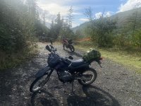
Thanks RoadCzar! We came through Holt Main yesterday and 'mosied' our way down Jordan Main to Forby East Main yesterday, turned back due to timing and came back out via Kapoor Main - we may or may not have had to made our way around a gate or two... I'm not admitting to anything. ๐Ÿ˜‡

We're planning on going the same route next weekend, hopefully coming out by Jordan River, hit Renfrew overnight, then hopefully come back via Gordon River area... will keep you posted on it goes.๐Ÿ‘
 

Dual Wanderers

New member
Hey again... if anyone's curious, they've unfortunately dug up the road between Diversion Reservoir and Bear Creek Reservoir... we could still get by on our small bikes but I think it'll be one big mud puddle pretty soon. ๐Ÿ˜’

The dug up is at these coordinates: N48ยฐ 30.041' W123ยฐ 56.616' (not a great pic unfortunately but you get the idea.)

Great trip, even in spite of the downpour on Sunday! ๐Ÿ˜…


IMG_0509.jpg
 

RustyOlive

New member
Hello. Interested to see how this thread grows.
I have recently moved back to the island after being gone for 20yrs. Wow has a lot changed.

I have been eyeballing this route on the Gaia app as well and been wondering the same thoughts. Any progress since this thread was started?

I would love to try this out.
 

Dual Wanderers

New member
Welcome back!!! ๐Ÿ‘๐Ÿฝ
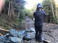
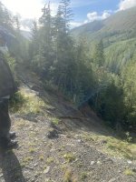
A few weeks later we thought we would try and check out the old Bedsprings Bridge location (Renfrew Main) then backtrack to head up Lens Main for a wander, as in alternate route to Renfrew ... BUT there's a MASSIVE washout (as in NO road) at the following coordinates : 48.60308, -123.94688
I'll attach a couple pics (Not great quality though)
 

Attachments

  • 1CE983D8-4A4C-42B3-8C1C-42927D754199.jpeg
    1CE983D8-4A4C-42B3-8C1C-42927D754199.jpeg
    1.4 MB · Views: 13
  • D9CD86D0-D072-43C3-93F5-A8DE709C501D.jpeg
    D9CD86D0-D072-43C3-93F5-A8DE709C501D.jpeg
    1.6 MB · Views: 13

Dual Wanderers

New member
p.s... We were basically trying to scout out the track from "Don's Adventure Rides" web-site... But alas no go up Lens... Not sure yet if there's another way ๐Ÿ˜‰ but that's the adventure and that's why we ride! ๐Ÿ˜œ๐Ÿ‘๐Ÿฝ
 

RustyOlive

New member
p.s... We were basically trying to scout out the track from "Don's Adventure Rides" web-site... But alas no go up Lens... Not sure yet if there's another way ๐Ÿ˜‰ but that's the adventure and that's why we ride! ๐Ÿ˜œ๐Ÿ‘๐Ÿฝ
Thank you!
I would like to get out and scout it as well. Agreed! Thats why we ride. ๐Ÿ˜
Iโ€™ll keep digging for intell as well. Lol if/when I get my butt back in there. Iโ€™ll take some photos of my findings too

Thanks again
 
Top