Stave East to Chehalis Connector???

O

old trials guy

Guest
There are a few folks interested in the possibility of creating a connector trail from East Stave Lake area to Chehalis. Looking at Google Earth and topo maps it appears that there might be some potential.

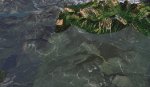
I sketched a yellow line on a Google Earth screen shot that shows one potential route. Many of the roads one can see on Google Earth are no longer accessible but I think it is worth doing some exploring.

From the Chehalis side I know you can get quite close to the east end of the yellow route from Dickson Lake or Statlu Creek. It would be interesting to explore that area and see how close one can get using GPS coordinates. Likewise, from the Stave side it looks like there maybe more than one spur road above Salisbury Lake that might get close.

Once the snow disappears I plan on taking a couple of trips into the area from either side and do some exploring.

If such a trail could be established it would really open up a prime dual sport riding area with many possible loops to enjoy.

I will update this thread if I have any luck and certainly welcome any suggestions or advise or help.

otg
 

Attachments

  • Stave Chehalis Connector.jpg
    Stave Chehalis Connector.jpg
    80.6 KB · Views: 3

tomcycle

Past President DSBC 2004 -2018
Staff member
imported post

imported post

Done lots of riding there over the years, just not recently:gaah:

Count me in when it comes time for some work

Tom
 
F

franhoser

Guest
imported post

imported post

OTG, I would be very interested in this in my back yard. Let me know if you need any help. As of tomorrow I will have a GPS as well. I know PistolPete andgangpocked around the Sylvester side last year. I think he may have some GPS routes as well. He mentioned he got very close.

I know Tom is getting a lot of support in Chilliwack this Sunday but if we can find two points to connect to then it's just a matter of making a trail. I'm sure you would get a lot of support if we needed to punch a trail trough.
 

cficare

New member
imported post

imported post

Hey guys, I went riding up Chehalis lake a couple weekends ago. There is a FSR at Skweelpell (sp??). I went about 6 km up then hit some snow and turned around. Not even sure if this is going in the right direction,but up until there the road itself was OK. Looks like there was some logging done recently. Really,I should get me one of those them GPS's so I could add a little more to your post! Jamie.
 

PistolPete

New member
imported post

imported post

OTG...a few of us have found what I think to be the spur on the Stave East side that you would be looking for. According to my GPS it is around 400m to the road on the Chehalis side. I will see if I can dig up my GPS tracks. PM me your email addy and I will send them to you. I would be interested in helping clear trail once the snow clears and my bike is back on the road (waiting for parts from the states).
 
O

old trials guy

Guest
imported post

imported post

Thanks for all the support for this project.Can anyone report on the current snow levels around East Stave? I am eager to start exploring but no sense heading out there if it is still snow bound especially in the higher elevations.

otg
 

North

Active member
imported post

imported post

Count me in too.


What lake is that in the bottom left of the picture, Salsbury? I am tyring to get a bearing on the map.
 

Phoenix

New member
imported post

imported post

My primary interest is the riding such as this close to homebase, would love to have loop like this that could be done on my current ride(the heavy bagged out ol' DR650). Plan on using the Gps to get the basic easy stuff in the areamapped and willing to help out as far as my riding skills can take me.


As usual I have bitten off more than I can chew for this weekend, but think I can squeeze in a quick Sunday(after Bruces Breaky)ride up Sylvester way to check on snow levels.
 

sueandal

New member
imported post

imported post

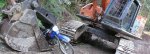
There is this real hungry excavator that found me on the chehalis FSR yesterday. You guys had better watch out for him !!
 

Attachments

  • ex eats me.jpg
    ex eats me.jpg
    185.7 KB · Views: 1
O

old trials guy

Guest
imported post

imported post

North wrote:
What lake is that in the bottom left of the picture, Salsbury? I am tyring to get a bearing on the map.
You are correct, that is Salisbury. Looking at Pete's tracks there maybe a more favourable spot further north that could connect to the top end of Statlu Creek.

otg
 
O

old trials guy

Guest
imported post

imported post

sueandal wrote:
There is this real hungry excavator that found me on the chehalis FSR yesterday. You guys had better watch out for him !!

Did you go up Statlu Creek by any chance and is there much snow left?

otg
 
F

Fumanchu

Guest
imported post

imported post

It's good to see the interest in this area as there are plenty of old roads just waiting to be ridden.The past couple of years I have been in that area exploring the possibilities of cutting trail from the upper Statlu creek to the Roaring creek FSR that connects with the upper Stave lake FSR.Imagine, access to a prime area virtually untouched by anyone save a few loggers, perhaps the best fishing holes in the lower mainland, and of course the last known camp of Robert A. (volcanic) Brown.


See the line in red?


http://s148.photobucket.com/albums/s28/nayrnrop/?action=view&current=3.jpg
 
O

old trials guy

Guest
imported post

imported post

sueandal wrote:
There is this real hungry excavator that found me on the chehalis FSR yesterday. You guys had better watch out for him !!

Damn transformers lurking everywhere. I fitting end for a DR200. :mad3:

otg
 

Randaroo

Member
imported post

imported post

while visiting sloquat this spring I couldn't help but notice a powerline being pushed up that valley. then I notice the stave/sloquat pass is only790 meters elevation.

Anyone know if a powerline is running up the stave to meet this one, if so a road connection?

Not trying to highjack this post, its just your neighborhood, thought you's may know something.
 

PistolPete

New member
imported post

imported post

The powerline should befor a run of the river project around Port Douglas/Tipella. I am not sure where they are connecting to the main grid with their lines. I guess we will have to go and do some exploring.

I will be working with the BC Hydro Lowermainland Transmission guys on Monday. I will ask them if they know where the lines will tie in. I do know that in BC they use helicopters A LOT to build the transmission system. Just because there are hydro line and a right of way up amountainside doesn't mean there is a road or trail.

I have been to the north end of Stave on the East Side. There is a massive rockslide across the road, and from what I can tell (in person and on maps/gps) the road never descended down to the lake and on up Stave River.
 
O

old trials guy

Guest
imported post

imported post

Hi Pete:

Have you ever ridden to the far east end of Statlu FSR in the neighborhood of Blacklock Creek? I wasn't sure from your GPS files if you have ridden that one. Also what is the terrain like on the west side of the same pass. Google Earth only has low res pics for that small section and I plan to go up and have a look but thought you could give me some insight.

otg
 
F

Fumanchu

Guest
imported post

imported post

I've ridden up the Stalu past Blacklock a couple of times.There was a rockslide the first time that turned into a real mess by the time I went up again.


Blacklock road

22553.jpg


Upper Stave from Kenyon lookout.(Trail would have to be cut from x to x)

kienyon015.jpg


Roaring creek FSR from the sadle above Blinch lake.Probably the easiest way to access the region would be to cut trail from the end of the upper statlu to here.

40126.jpg


Following this route.(proposed route in red)

3.jpg
 
Top