Kootenays GPX Discussion

Sparkle

New member
It looks like everyone agrees a separate "Topic" for discussion etc. is worthwhile. So here it is. Ultimately if the administrater creates a new category, this stuff could be moved, but in the meantime this might be a good place to learn how to share files and use GPS's, and discuss the actual routes.

Sparkle
 

Sparkle

New member
imported post

imported post

Hi Again:

In the Kootenays GPX thread Bubba Zanetti looked for tips on using his Garmin 60Cx. I have to confess Bubba, I'm a poor guy to ask about GPS or computers and I'm hoping this thread will draw some expertise from the group that will help us all. So, all this stuff is experimental for me, and may not be the professional approach, but for what it's worth, here's everything I know:


Sparkle
 

Sparkle

New member
imported post

imported post

My very first way of using a GPS was to simply ride along punching in waypoints now and then to record where I have already been. When I wanted to plan trips I would simply measure a few co-ordinates from a map-book and manually enter them into the GPS, then create a route using the new waypoints.

Even now my GPS is mostly used as a data recorder to to record the tracks and waypoints you punch in as you go along and it's hard to use a stand-alone GPS for actually PLANNING a trip that you have never done.

So the next step was using a mapping program. I have "MapSource" and a few others but my favorite is still "GPS Trackmaker". It's a free program, full-featured, without advertising and no restrictions.

http://www.gpstm.com/

"Mapsource" along with Ibycus maps is probably the best for Garmin users, but the main feature of a mapping program for me is the simple ability to upload and download information to the GPS. My initial method was to draw or download a track to the map on the computer, then create waypoints along the track.

The easiest way to use GPX files that you download from the net is just save them to a file on your computer, open them in your map program and create WAYPOINTS along the track. You don't even need a map on the screen to do this function just put in waypoints along the line. Then upload the waypoints to your GPS and save them as a "route". To use them, just make the route "active" on your GPS and follow the pointer.

The only problem with this method is if your intended route is switchbacks on a mountain or a tight winding trail, you might need dozens of waypoints which on my GPS gets a little cluttered. City streets are a problem too, with a waypoint required for every turn and just clicking them in on the computer gets to be time consuming. And if you have more than a few Routes saved, you might have hundreds of waypoints on your GPS.
 

Sparkle

New member
imported post

imported post


The next step...TRACKLOGS...Now, instead banging in a bunch of waypoints I just use the track pencil on the computer to make a track along the path I want to follow. If I have a GPS file downloaded from the net, I can "MERGE" it and integrate it with the new track.

Then you just save as a new gpx file, or files, load them to your GPS and follow your new tracks. It works much like following a route of waypoints...except you see the track and not the waypoints, and there's 500 of them for each file rather than just a few.


There are different ways you can use tracks on a GPS. You can just bring up the track on your GPS screen, or map, and follow it on the map navigation screen with your "I am here" icon or pointer. Or you could use "trackback", after you reverse the track on your GPS in which case your map pointer, and other data display will be active too, just as when you are following a Waypoint route.

After I load the track on the GPS I just go to "saved tracks" select the one I want, decide whether I want to start from the end or the beginning and press "navigate". Then as I'm riding along, if I see something notable, or take a picture, or just want to remember the spot, that's when I create a waypoint on the GPS for future referance. If I stray from the track, and do some exploring, it's easy to just navigate back to the track, or project a waypoint onto the track to navigate to. As you ride, your GPS will generate the usual "active tracklog" which should overlay the saved one you are following if everything is going to plan. The active tracklog isn't limited to 500 points but usually much more. In the case of a Garmin 60Cx it is 10,000 points.
 

Sparkle

New member
imported post

imported post


As Ripple points out including your home location on a track you share may have it's dangers.. So it's fine for your own personal tracks to start from your house, but shared tracks should start from a remote easy to find landmark or junction. Then if the user wants to add his own track to get to the landmark, it's up to him.

Most of the reason I'm interested in GPS and track sharing is to have the ability to see where other people are riding, and to communicate my tracks to others by way of sharing the knowledge. In combination with Google Earth a GPS can reduce a lot of wasted trips trying to locate an interesting spot. It's a safety feature also, if you have a planned route on the computer at home and you don't show up on time...someone has a chance of finding you.


Sparkle
 
R

Ripple

Guest
imported post

imported post

I'm glad you have the time to put together a comprehensive tutorial. I mean to do so many things but am still recovering from 12's and weekends so have a bit of trouble getting motivated.
"It's a safety feature also, if you have a planned route on the computer at home and you don't show up on time...someone has a chance of finding you." As my wife is still working on being computer literate I usually leave my mapsource window up for her when I go. If I leave my planned route I can call, text, or email my coordinates and direction of travel. Gotta love the new cells. Just remember to do your business while you still have signal.
 

Sparkle

New member
imported post

imported post

I'm not sure I did the right thing on this post....my wife always says I tend to go overboard talking about stuff I don't understand myself....

I'll leave it for now, and edit it down if it's a problem.

At the moment Ripple, it's -16 in the carport and for the first time in my life I wish I was raking the lawn. Hope it breaks soon...sheesh...global warming.

Have a good one.

Sparkle
 
M

myran

Guest
imported post

imported post

PLEASE DON'T STOP! I just picked up an old Garmin 72 for $25, and your first message is ME to a tee. Send more help.
 

Sparkle

New member
imported post

imported post


I spent a little time with "MapSource" just find out what it's really all about, and I can add a few details to my procedure pertaining to MapSource, which until today I haven't really tried.

To test it, I started my Mapsource program, and then went to FILE, and OPEN. On the "open" panel it was looking for "gdb" files (Garmin Data Base), but on the "dropdown list" I selected "All Files" and then selected "Graycrk GPX" from my hardrive for a test (the same file I posted on the other thread). It opened the on the screen immediately, showing the track and waypoints.

Just out of curiosity under "Tools" I found a method of joining separate tracks, but I couldn't find a "Tracklog Reducer" which was puzzling.

So I did a little research.And I think what happenswhen you save an active track on a Garmin GPS, or if you transfer a GPS Track to a Garmin GPS using MapSource, the Garmin GPS automatically sizes the track to fit the memory location. For example, if you take a long ride, and your "active tracklog" is almost full, (10,000 points), and you decide to save the track...it's automatically reduced to 500 points for most Garmin units. (I think Colorado's have 750).

At first I thought, that must lose a lot of accuracy.....So I did some more research.

It turns out that by reducing the active-trackpoint number, the accuracy of the track actually IMPROVES. Remember the discussion in another thread about the accuracy of the Garmin tracks? And Ripple once complained that his active track showed his speed as 180KPH and looked like a saw-tooth or herringbone pattern....Some others complained that the length of the active track was too long or it changed when they saved it...

It seems what happens is the active track (The one that starts when you turn on your GPS) plots the inaccuracies (EPE 12 meters,EPE 32 meters etc.) as you go, and calculates these inaccuracies into the distance traveled (and speed of course, because it thinks it's travelling further). So although your path might be straight, the GPS might be recording a bunch of jogs. Most times not enough to matter, but sometimes under bad satellite conditions it can be more severe.

However, when you save the track to memory, the GPS averages the points to reduce the number, and the jogs dissapear.... Then the distance travelled reduces, as does the calculated speed.

The bottom line is, when saving tracks to a Garmin GPSI don't think youhave to worry about reducing the tracklog to save a track in the GPS, or when you transfer a track from the computer. And by allowing the tracklog to reduce you're not sacrificing accuracy.

Back to the Graycrk GPX on the computer screen using "MapSource"....

I plugged my Garmin Geko cable into the computer, and turned the GPS on. On the left Mapsource panel I clicked tracks, and I could see the 2 tracks listed (Graycreek and Power Line). I clicked on "Waypoints" and I could see the three waypoints listed (Way 1, Way 2, and Summit).....

On the toolbar there's a button marked "Send to Device"...I clicked it and a panel opened saying it had found my Garmin Geko, and below it it said "What to Send" with 4 selections: Maps, Routes, Waypoints and Tracks. I selected Waypoints and Tracks.

Then I selected "Send" and in a few seconds it said "Transfer Complete". There's a selection that also says "Shut off GPS on completion" and I left that as is. When it was finished the Geko was off.

I unplugged the GPS, pushed the start button and went to the menu page of the GPS and looked under "Saved Tracks" and there they were: Graycreek and Powerline...and under "Saved Waypoints" I had "Way 1", "Way 2", and "Summit". Then I selected the track and there it was, along with the names and waypoints, ready to navigate with the GPS.

Well...I wish I could, but it's -16 degrees here today, and fresh snow....Shucks.

An important thing to mention before you transfer your Tracks and Waypoints from your computer is that you should give them a name you recognize so you can pick them off the GPS menu. If you don't they'll end up being called 0001, 0004, 0007 etc. and it's very confusing when you're lost on the trail to remember which one is which.

Another tip is when you ride your bike up to a point where you want to record a track, clear the existing track to avoid confusion and clutter. It'll save trying to delete portions later when you save the track and then share it with the rest of us.

There is a ray of sunshine....... I'm just about tapped-out on GPS's....:dr:

Sparkle
 
R

Ripple

Guest
imported post

imported post

My gps set is the Garmin etrex legend (nice blue matches the bike) and the topo Canada Mapsource package. It was $169 at Wal mart I think. If I recall the unit itself is anywhere from $80-149 and the software with full topo coverage of Canada roughly the same seperately. I think I spent over half of the package price on 5 paper topos when I first moved here so a great deal in my eyes. This is why I use mapsource. Found my gps unit while cleaning up so YAAAA! This thread is definately opening my eyes to new ideas and software though. I still carry backroads mapbook and paper maps so I can get the big picture while zoomed in enough to see the terrain and roads.
 

Sparkle

New member
imported post

imported post

That's greatyou found your gps Ripple....I felt sorry for it thinking it was out there somewhere knowing exactly were it was, but it lost you....

All thisplaying is opening my eyes too, and I see the convenience of Mapsource with a Garmin....for one thing I think my"Trackmaker" program transfers tracks as "active tracks" so you have to manually save them and fool with the name on the gps. But I noticed Mapsource loaded the tracks, name and all, direct to the gps "saved tracks" in one step.

cool....
 
W

Worone

Guest
imported post

imported post

It would be excellent if you guys put up your favorite riding GPS files for us Alberta guys. I have used mapsource to make routes but haven't uploaded any to my actual device, so I'm not sure how easy it would be. Planning on doing some rides on the fire roads that show up on google maps this spring. Let's see you favorite places!
 
W

Worone

Guest
imported post

imported post

I have a Garmin 5000, made for RVs, in an Aqua Box, at 5.2 inches it feels like a Dakar road book on the bike. Anyone ever upload a route from Mapsource, it looks easy, I guess I will try a local route and see how it goes.....I'll keep you posted. Thinking of trying a gravel route from Fernie to Radium Hotsprings, any ideas?
 

Sparkle

New member
imported post

imported post

Worone wrote:
It would be excellent if you guys put up your favorite riding GPS files for us Alberta guys. I have used mapsource to make routes but haven't uploaded any to my actual device, so I'm not sure how easy it would be. Planning on doing some rides on the fire roads that show up on google maps this spring. Let's see you favorite places!

Hi Worone:

You can find some of my files here in an associated thread to this one:

http://www.dualsportbc.com/forums/view_topic.php?id=7693&forum_id=56

I started both gps threads to encourage posting Kootenay rides some time ago...not many have done so. Please add to it anytime.

Uploading from mapsource is very easy...just follow my postabove made in March 10 2009

PlanningGPXroutesusing Google Earth (to upload to your GPS) is easy using this neat utility. You just zoom in to the area, draw your track, and save as a gpx, open it with mapsource and upload to your GPS.. http://www.gpsvisualizer.com/draw/

Another interesting site is

http://bike.stu.ph/rides/ where you can post your gpx file and see it on a map, as well as downloading other files in several formats including gpx.

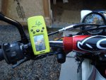
My gps is jus a lil guy... good luck,

Sparkle
 

Attachments

  • DSC00340.JPG
    DSC00340.JPG
    161.2 KB · Views: 0

Farp

Active member
imported post

imported post

I plot a path of where I want to go in Google Earth and I save it as a KMZ file. Then I go to the GPS Visualizer website where you can translate the KMZ file into a GPX file. Here's the link:

http://www.gpsvisualizer.com/

There are no charges, registration, or anything for using this site and it provides instructions for the translation process and for saving your GPX file to your hard drive. It's really quite simple.

Once I have the GPX file on my hard drive I open it with Garmin Mapsource and from Mapsource I send the path to my GPS device. I have a Garmin GPS60CSx and a Garmin Etrex Venture HC.

The benefit of using Google Earth for this is you can plot your path from a satelite view and pick out roads and trails that are not shown on the topos. Also, Google Earth is free whereas the topos are quite expensive. I have been doing this for about 6 months now and it works very well.

Hope this helps.

John
 

Farp

Active member
imported post

imported post

Hey, Sparkle beat me to the punch, great minds think alike eh, Sparkle.

John
 
W

Worone

Guest
imported post

imported post

Thanks for the info and links, this looks like it will be a whole look better than going off of a sheet of paper with just my odometer read outs to know when to turn!
 

Farp

Active member
imported post

imported post

One more thing. When you return from a ride with your path logged in your GPS device you can upload it into Google Earth and see where you've been. Just open Google Earth, click on tools on the top menu bar, click on Magellan or Garmin and then import down at the bottom and your days ride will appear on the screen.

John
 

Sparkle

New member
imported post

imported post

Farp wrote:
Hey, Sparkle beat me to the punch, great minds think alike eh, Sparkle.

John

John, I'm so slow this morning I'm just finishing breakfast...must be the connection :D

mike
 

aebbern

Member
imported post

imported post

The benefit of using Google Earth for this is you can plot your path from a satelite view and pick out roads and trails that are not shown on the topos.
Another benefit of Google Earth is the ability to use Street View to check on availability of gas stations in very small towns. I'm currently planning a DS ride through some remote areas of Wyoming, Colorado and Utah... have used the Street View on GE a few times now along the proposed route to see where I can get gas.
 
Top