imported post
imported post
I spent a little time with "MapSource" just find out what it's really all about, and I can add a few details to my procedure pertaining to MapSource, which until today I haven't really tried.
To test it, I started my Mapsource program, and then went to FILE, and OPEN. On the "open" panel it was looking for "gdb" files (Garmin Data Base), but on the "dropdown list" I selected "All Files" and then selected "Graycrk GPX" from my hardrive for a test (the same file I posted on the other thread). It opened the on the screen immediately, showing the track and waypoints.
Just out of curiosity under "Tools" I found a method of joining separate tracks, but I couldn't find a "Tracklog Reducer" which was puzzling.
So I did a little research.And I think what happenswhen you save an active track on a Garmin GPS, or if you transfer a GPS Track to a Garmin GPS using MapSource, the Garmin GPS automatically sizes the track to fit the memory location. For example, if you take a long ride, and your "active tracklog" is almost full, (10,000 points), and you decide to save the track...it's automatically reduced to 500 points for most Garmin units. (I think Colorado's have 750).
At first I thought, that must lose a lot of accuracy.....So I did some more research.
It turns out that by reducing the active-trackpoint number, the accuracy of the track actually IMPROVES. Remember the discussion in another thread about the accuracy of the Garmin tracks? And Ripple once complained that his active track showed his speed as 180KPH and looked like a saw-tooth or herringbone pattern....Some others complained that the length of the active track was too long or it changed when they saved it...
It seems what happens is the active track (The one that starts when you turn on your GPS) plots the inaccuracies (EPE 12 meters,EPE 32 meters etc.) as you go, and calculates these inaccuracies into the distance traveled (and speed of course, because it thinks it's travelling further). So although your path might be straight, the GPS might be recording a bunch of jogs. Most times not enough to matter, but sometimes under bad satellite conditions it can be more severe.
However, when you save the track to memory, the GPS averages the points to reduce the number, and the jogs dissapear.... Then the distance travelled reduces, as does the calculated speed.
The bottom line is, when saving tracks to a Garmin GPSI don't think youhave to worry about reducing the tracklog to save a track in the GPS, or when you transfer a track from the computer. And by allowing the tracklog to reduce you're not sacrificing accuracy.
Back to the Graycrk GPX on the computer screen using "MapSource"....
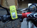
I plugged my Garmin Geko cable into the computer, and turned the GPS on. On the left Mapsource panel I clicked tracks, and I could see the 2 tracks listed (Graycreek and Power Line). I clicked on "Waypoints" and I could see the three waypoints listed (Way 1, Way 2, and Summit).....
On the toolbar there's a button marked "Send to Device"...I clicked it and a panel opened saying it had found my Garmin Geko, and below it it said "What to Send" with 4 selections: Maps, Routes, Waypoints and Tracks. I selected Waypoints and Tracks.
Then I selected "Send" and in a few seconds it said "Transfer Complete". There's a selection that also says "Shut off GPS on completion" and I left that as is. When it was finished the Geko was off.
I unplugged the GPS, pushed the start button and went to the menu page of the GPS and looked under "Saved Tracks" and there they were: Graycreek and Powerline...and under "Saved Waypoints" I had "Way 1", "Way 2", and "Summit". Then I selected the track and there it was, along with the names and waypoints, ready to navigate with the GPS.
Well...I wish I could, but it's -16 degrees here today, and fresh snow....Shucks.
An important thing to mention before you transfer your Tracks and Waypoints from your computer is that you should give them a name you recognize so you can pick them off the GPS menu. If you don't they'll end up being called 0001, 0004, 0007 etc. and it's very confusing when you're lost on the trail to remember which one is which.
Another tip is when you ride your bike up to a point where you want to record a track, clear the existing track to avoid confusion and clutter. It'll save trying to delete portions later when you save the track and then share it with the rest of us.
There is a ray of sunshine....... I'm just about tapped-out on GPS's....:dr:
Sparkle