Was based out of Lillooet last week. Intended to go for China Head from the Fraser River side since riding solo and a more "gentle" approach after failing to get up Poison Mtn from Mud Lakes last year (again solo, getting older, and modest skills so far less of a risk taker than I used to be!).
The Mackay Creek fire 25km north is likely now into mop up but was told there would be good chance I'd be turned around by the Forest Service / Fire Fighters if I tried heading that way. The day I intended to go the smoke was pretty bad - was improving later in the week but never fully gone - you can get a sense from this -
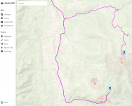
Did get rain one night leading to wicked gumbo mud on the usual approach to Cornwall Hills (see attached) and that did help bring the smoke down but noted it was coming back as I was leaving town the next day.