northwest connector found

bossche

Member
imported post

imported post

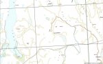
Here is a picture of a topo map that was requested in an earlier post. The blue route on the left is the gpx track from the Oct 4th work party. The blue track to the right is OTG's Norris section that he posted as nothwest.kmz tracks. The red line is the section that is missing between the 2 logging roads. Note the topo map I have is for roads as of year 2000.


Here is a track that I drew that connects the Oct 4 route with the Norris route that can be up loaded in to your GPS if someone is going to attempt to walk the proposed connector.
 

Attachments

  • oct4toNorris_theory.gpx
    2.9 KB · Views: 0
G

Guest

Guest
imported post

imported post

Damn my memory sucks. I'm still confused.
Where did we stop & take the photos
(the dead end high up on the mountain)?
Was it at the end of the red road where
I placed theX?

Also, the blue line you show as our way
out (on your map) doesn't exist on any
map I look at, even imapbc. Are you sure
that's the way we came out?

God I'd be the worst navigator ever...

map02.jpg
 

North

Active member
imported post

imported post

Hi 6fiddy,

Looking at topo, backwoods, hiking and other maps can drive you crazy. I have three different map-books and they all do not show the same roads. Thats why it's great to have the "Track" to a place from some-one who has already been there. A GPS can fail, so you also need a Map. But no map has all the logging roads, spurs, etc, in it.

You took pictures on the dead-end on the side of the montain top, were we stopped and walk around. It's the were the red dot is on the map below. Mind you I had to draw in the green road, because it was not on the map. So it is off a bit, but that still is the general area.

I have found that the best map book is the Backroad Mapbook, outdoor recreation guide. (The vancouver, coast mountains one for were we live.) It does show the roads that we took out.

And that is the route we took home and some of the road is not on your map. We followed the track/route that I got from otg. That is what I used to get us In and Out.
 

Attachments

  • map04.JPG
    map04.JPG
    76.3 KB · Views: 0

bossche

Member
imported post

imported post

If you guys have GPS tracks from your rides and hikes send them to me at [email protected] and I can load them into the topo map and post the images. Make sure that you mark a waypoint in the GPS when you take photos or change from one road/trail to another so it will show up on the topo.
 

Farp

Active member
imported post

imported post

Here are a couple of views of the area that you're interested in. The first is an overhead view with Salsbury Lake in the upper right hand corner. The second is the same view but angled down to give a better idea of the contour. These views are from the south looking north but if you want I can give you views looking from any direction. Hope this helps.

John


url]
436Salsbury_Lake_OH_view.jpg


436Salsbury_lake_Contour.jpg
 

North

Active member
imported post

imported post

Those are great shots Farp. Can you post one with salsbury and dickson lakes in the same shot, looking straight down?

In that last picture it looks like short hike from one of the haul roads to Statlu landing. By short, I mean a couple of hours.

Thanks

Rick
 
O

old trials guy

Guest
imported post

imported post

Farp wrote:
Here are a couple of views of the area that you're interested in. The first is an overhead view with Salsbury Lake in the upper right hand corner. The second is the same view but angled down to give a better idea of the contour. These views are from the south looking north but if you want I can give you views looking from any direction. Hope this helps.

John
It's great to see everyone is getting interested in our project. Your pics looks a lot likesome of my previous posts except without the tracks.

<<http://www.dualsportbc.com/forums/view_topic.php?id=9026&forum_id=16&page=7>>

I have studied this terrain extensively using Mapsource and Google Earth but the proof is in the pudding. Riding and walking the area is the only way to really see the condition of the old roads.

We made some good progress today, I will post up pics and gpx tracks later this evening and make some recommendations on the next steps.

otg
 
O

old trials guy

Guest
imported post

imported post

Chapter 23 of the continuing saga of the Northwest Connector:

October 24, 2009. We were rewarded with splendid weather for this late in the season. Cloudy with sunny breaks and temperatures reaching into the low teens.

6fiddy, volcon and me, the old trials guy headed out from Bruce's to Dewdney and a familiar ride up Norrish Creek. The gate was closed today so we slugged our way through the bypass trail. Although soupy it was quite passable. I couldn't help notice the very large sign telling us how our watershed will be protected from people like us and the words "Road Closed". I guess that clearcut logging operation up there doesn't impact the watershed nearly us much as us dirt bikers churning up the logging roads :?.

Logging was going full bore so we had to take care going around the equipment. Once past the powerline we climbed past Dickson Lake. Some of the ditches filled with rocks are a challenge but Volcon managed to guide his KLR through with hardly a spill (well maybe a couple of low speed tip overs). This is a really nice ride for a B rider and can be done on a KLR but be prepared to drop your bike as it is easy to get high centered in a few of the stream crossings.

Shortly after we dropped down from the Dickson Lake road we crossed the bridge on Statlu Creek. Just past the bridge is the spur road that takes you to the south west and if you stay on the right fork it eventually ends up at what I call the Statlu Landing. The climb is rocky but the road is openwith few if any face slappers. You get a great view on a clear day. But today we were looking for a different path.

We continued north on Statlu FSR keeping an eye for the haul road that potentially could hook up to the North Lost Creek road we have been busy clearing.A short distance down the road we rode through the lower portion of a large slide, the one that is clearly visibly on Google Earth. The haul road should be close.

Another kilometer and there to the left was a grown over grade. 6fiddy and I headed up through the salal and salmon berries until it was just to overgrown to carry on by bike. Volcon stayed at the main road to keep an eye out for bike bandits and 6fiddy and I headed up the remants of the haul road. At first it was fairly grown over with the usual assortment of brush but about 400 meters up the underbrush thinned out and at that point we wish we had our bikes.

At about 500 meters we crossed the creek that runs down the slide we crossed down below. I commented that it would be one heck of a section for a pro trials rider but feasible.The grade continued on and I watched our progress on myGarmin as we got closer and closer to a waypoint I set marking the summit of the Northwest Connector. We carried on until my old knees started talking to me and the brush started closing in again. There were a few nasty spots including a short sidehill leading into a creek but up to the point we turned around on foot it would be very passable on bike (with some work clearing and some pick work here and there).

The end result is we got within about 1200 meters from the connector trail we have cut on the other side. You can clearly see the summit from several points along the haul road. The condition of the grade was surprising good, growth is not as extensive as on the Sylvester side and I think the trail to were we finished could be cleaned up in a day with some help.

There is still the daunting task of cutting a fresh trail through the old growth at the summit and the terrain gets steeper as you climb up the hillside but I think there is some promise. I know this won't be completed this year but I think Flyn can take some satisfaction from picking a course that has great potential. A few weeks ago I was somewhat discouraged but after today I have renewed enthusiasm for establishing the Northwest Connector.

Here is a google earth view which includes actual tracks that have either been ridden or hiked.

otg


North

Active member
imported post

imported post

Thats great otg,

I was wondering if you could post a zoomed out picture so I can see were that is in reference to a known lake and or other trails.

Thanks

Rick
 

Hamon

Member
imported post

imported post

Very cool. I've not yet been able to get out on one of these recon missions yet, but I sure would like to. It'll be nice to finally get this punched through, and I'm definitely up for blazin' some trails.

On a side note, saw volcon on his way home. He didn't look nearly as tired as he should've. :wi:;)

Travis
 
O

old trials guy

Guest
imported post

imported post

Here are a couple of pics from today's adventure:

volcon and 6fiddy on the Statlu Creek Bridge above Dickson Lake:


The old grade heading west from Statlu Creek Road:


Another view:


otg
 

redpillar

Member
imported post

imported post

I have been watching this thread for a while and have spent a bit of time figuring out how to post up a kmz file. I am pretty sure this should work and the files come from the Van coast mapbooks CD Hope they help in your quest. If this does not work I can email them to someone.
 

redpillar

Member
imported post

imported post

Hey guys, I have been following your adventure for a while and I have been trying to post up a couple or three KMZ files from Backroad mapbooks which will overlay the maps on google earth. They are too large to post so if I could get an email address I could email them.
 

North

Active member
imported post

imported post

redpillar wrote:
Hey guys, I have been following your adventure for a while and I have been trying to post up a couple or three KMZ files from Backroad mapbooks which will overlay the maps on google earth. They are too large to post so if I could get an email address I could email them.

Thanks

I sent you a PM.

Rick
 

North

Active member
imported post

imported post

That is great! If things go well, I will try to hike from the Sylvester side tomorrow.

This could mean a Knighthood for you otg and Flyn. :clap:
 

tomcycle

Past President DSBC 2004 -2018
Staff member
imported post

imported post

Now it looks like you guys found something

Looking on GE is thata slide you guys had to ride over and the creek at the end of you track does it have a bridge that is still in tact.

What do you think the proposed difficulty will be for this route.

If it doesnt snow next weekend I could be tricked out of a day of house chores;)

Tom
 
Top