O
old trials guy
Guest
imported post
imported post
tomcycle wrote:
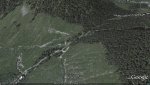
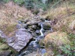
The slide is the result of a creek that runs straight down the mountainside and has cut a wide swath which is visible on GE. Fortunately, there is a huge rock shelf supporting the roadbed where is crosses the creek. The bridge is gone but there is no significant bank on either side and a bit of pick work should provide a decent line.
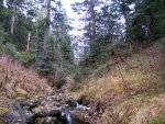
There is a 50 meter section of side hill leading into the second creek. This area will call for picks and chainsaw to clear an approach to the creek. The bridge is long gone but the grade is gentle and the creek bed is almost at grade. There are a couple of remnant logs that will have to be cut and moved.
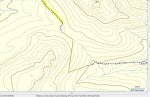
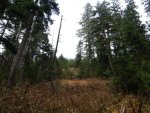
Before any of this grunt work begins it would be best to try and hike from the west side through the old growth to approach our track from yesterday. The clear cut area on top is really rugged and it will be a challenge to find a route through that and the old growth. If that is possible then there is the last 500 meters coming down from the top to the point we walked to yesterday.Anold spur roadappears to continue a good ways up there but it is steep. This last stretch has been recently tree planted and covered in 6 foot firs.
The good news is that we have a feasible route on both sides that gets us within about a 1000 meters but that last kilometer is the real challenge. If we can figure out a trail to connect then we can use all the help we can get cleaning it up.
In the back of my mind is the fact that the water district is preparing to fully close off Norrish Creek so this popular area will only be accessible from Chehalis. Without a connector I sense this area will become unused and overgrown and eventually just a memory.
otg
imported post
tomcycle wrote:
Now it looks like you guys found something
Looking on GE is thata slide you guys had to ride over and the creek at the end of you track does it have a bridge that is still in tact.
What do you think the proposed difficulty will be for this route.
If it doesnt snow next weekend I could be tricked out of a day of house chores
Tom

The slide is the result of a creek that runs straight down the mountainside and has cut a wide swath which is visible on GE. Fortunately, there is a huge rock shelf supporting the roadbed where is crosses the creek. The bridge is gone but there is no significant bank on either side and a bit of pick work should provide a decent line.
There is a 50 meter section of side hill leading into the second creek. This area will call for picks and chainsaw to clear an approach to the creek. The bridge is long gone but the grade is gentle and the creek bed is almost at grade. There are a couple of remnant logs that will have to be cut and moved.
Before any of this grunt work begins it would be best to try and hike from the west side through the old growth to approach our track from yesterday. The clear cut area on top is really rugged and it will be a challenge to find a route through that and the old growth. If that is possible then there is the last 500 meters coming down from the top to the point we walked to yesterday.Anold spur roadappears to continue a good ways up there but it is steep. This last stretch has been recently tree planted and covered in 6 foot firs.
The good news is that we have a feasible route on both sides that gets us within about a 1000 meters but that last kilometer is the real challenge. If we can figure out a trail to connect then we can use all the help we can get cleaning it up.
In the back of my mind is the fact that the water district is preparing to fully close off Norrish Creek so this popular area will only be accessible from Chehalis. Without a connector I sense this area will become unused and overgrown and eventually just a memory.
otg