northwest connector found

O

old trials guy

Guest
imported post

imported post

tomcycle wrote:
Now it looks like you guys found something

Looking on GE is thata slide you guys had to ride over and the creek at the end of you track does it have a bridge that is still in tact.

What do you think the proposed difficulty will be for this route.

If it doesnt snow next weekend I could be tricked out of a day of house chores;)

Tom

The slide is the result of a creek that runs straight down the mountainside and has cut a wide swath which is visible on GE. Fortunately, there is a huge rock shelf supporting the roadbed where is crosses the creek. The bridge is gone but there is no significant bank on either side and a bit of pick work should provide a decent line.

There is a 50 meter section of side hill leading into the second creek. This area will call for picks and chainsaw to clear an approach to the creek. The bridge is long gone but the grade is gentle and the creek bed is almost at grade. There are a couple of remnant logs that will have to be cut and moved.

Before any of this grunt work begins it would be best to try and hike from the west side through the old growth to approach our track from yesterday. The clear cut area on top is really rugged and it will be a challenge to find a route through that and the old growth. If that is possible then there is the last 500 meters coming down from the top to the point we walked to yesterday.Anold spur roadappears to continue a good ways up there but it is steep. This last stretch has been recently tree planted and covered in 6 foot firs.

The good news is that we have a feasible route on both sides that gets us within about a 1000 meters but that last kilometer is the real challenge. If we can figure out a trail to connect then we can use all the help we can get cleaning it up.

In the back of my mind is the fact that the water district is preparing to fully close off Norrish Creek so this popular area will only be accessible from Chehalis. Without a connector I sense this area will become unused and overgrown and eventually just a memory.

otg
 

tomcycle

Past President DSBC 2004 -2018
Staff member
imported post

imported post

Does anyone know the boundrys of this proposed watershed? or how we can find out about it?
 
O

old trials guy

Guest
imported post

imported post

I believe its the District of Abbotsford's watershed. I should have taken a picture of the sign however there have been other posts on the forum about this. I spoke with one of the loggers several weeks ago and he says they are planning a "big" gate that nobody will get by. I think Dickson Lake is part of the system but am only guessing as the road in is heavily gated and signed about a kilometer above the power line.

The active logging now extends past the powerline almost to Dickson Lake entrance.

I also noticed that the gate at the Chehalis junction is closed and locked preventing 4 wheel traffic through. That just doens't make sense as they are repairing the bridge at the foot of Margaret Creek road but then again, there is new active logging up in Blacklock Creek. I may sound like a broken record but it seems like they are slowly shutting down the whole province. They put up gates to keep out the public while providing roads for logging.I know logging will happen, I just hate paying for the roads they use and I am locked out:gaah:

otg
 

Farp

Active member
imported post

imported post

North wrote:
Those are great shots Farp. Can you post one with salsbury and dickson lakes in the same shot, looking straight down?

In that last picture it looks like short hike from one of the haul roads to Statlu landing. By short, I mean a couple of hours.

Thanks

Rick
Here's the view you wanted. I tried to photo-stitch several views together so that a greater resolution could be displayed but everytime I panned to the next view the screen scale would change and the stitched view became offset. This view was created by pasting a printscreen into photoshop and it's the maximum scale at this resolution that showed both Dixon and Salsbury on the same screen. Panning out any further in Bing maps resulted in a massive change in the screen display and the details completely disapeared. Dixon can be seen in the extreme lower right hand corner and Salsbury in the extreme upper left hand corner.

436Salsbury_Dixon.jpg


Let me know if you want a more detailed look at any particular area.

John
 

North

Active member
imported post

imported post

Thats great, thanks John.

I am hoping to get out hiking on Tuesday, it looks like it could be a sunny day.


Rick
 

Farp

Active member
imported post

imported post

I'm retired and available for riding, hiking, exploring or whatever 7 days/wk so if you want some company on Tue I'd be happy to go with you. My assumption is that you intend to ride up the Sylvester side as far as you can and then see if you can hike over Lost Creek North Pass to the route that OTG, Volcon, and 6Fiddy marked the other day. Is this correct?

John
 
G

Guest

Guest
imported post

imported post

North wrote:
Thats great, thanks John.

I am hoping to get out hiking on Tuesday, it looks like it could be a sunny day.


Rick

Hey Rick,

I might be able to join you but need to clear up a few things. I'll shoot ya a PM by tomorrow night letting you know if I'm in or out :)
 

sueandal

New member
imported post

imported post

Just got off the phone with tracey kyle from city of abbotsford.
She confirms the new bigger gate has been approved.
Also i asked and she will email me a map of the designated watershed area.
I asked about the city's intention to stop access from the chehalis side
She says that the city has not approved a gate in that location but that another
dept. (ministry of forests?) is blocking that end
Also that paperwork is being done to decomission many of the roads and remove at least one bridge to further restrict access :(
I will be posting the map as soon as i get it.


A bit more info on the decomissioning FSR's.
Two bids were placed ( by contractors)when the work was posted (from gov.).
Both bids were declined ( by gov. - may have not only been $ amount but also "ability" of contractors) was mentioned 2 me.

So the money is still available and the city is hopeful for a bid that becomes successful.
This is a 4sure thing they want done.
Some of the roads are not within their areasays city of abbotsford engineering dept. They included the position of the new gate, right behind the gate that already exists at 7.95 k

sorry 'bout the big print below, best i could do
 
O

old trials guy

Guest
imported post

imported post

sueandal wrote:
Just got off the phone with tracey kyle from city of abbotsford.
She confirms the new bigger gate has been approved.
Also i asked and she will email me a map of the designated watershed area.
I asked about the city's intention to stop access from the chehalis side
She says that the city has not approved a gate in that location but that another
dept. (ministry of forests?) is blocking that end
Also that paperwork is being done to decomission many of the roads and remove at least one bridge to further restrict access :(
I will be posting the map as soon as i get it.

al

:gaah:

This should be shared with all outdoor groups. This constant closure of areas for whatever new lame excuse is totally out of hand. Chehalis and Statlu are on the other side of the mountains from their precious watershed......otg


North

Active member
imported post

imported post

Last week when 6fiddy and I rode from Chehalis to Norrish we saw all the logging going on past the Norrish gate on the way back. All the wood and so called "Slash" being burned. Clear cutting logging.I should of stopped and taken pictures.

But "they" who ever "they"might be,are worried about the public using the land, who it belongs to in the first place. We Dualsport riders donot leave anything in the woods. We do not shoot up signs, etc. Anyways, I know I am Preaching to the Choir.

P.S.

To clear the air, I am not against Logging. The trees grow back and I use wood.
 

North

Active member
imported post

imported post

My track from my ride and hike today is a .gdb file and I can't post it here.

But, I got in the bush a bit late in the day. The hiking was slow and I did not have time to meet up with the route on the other side. As I was walking out it started snowing. I did take it easy as I was alone.

Rick
 
O

old trials guy

Guest
imported post

imported post

North wrote:
My track from my ride and hike today is a .gdb file and I can't post it here.

But, I got in the bush a bit late in the day. The hiking was slow and I did not have time to meet up with the route on the other side. As I was walking out it started snowing. I did take it easy as I was alone.

Rick

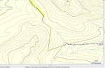
Here is North's track and the track we hiked on Saturday. I sketched in an approximate idea of a route and it calculates at approximately1.4 kilometers. My virtual track is intended to keep the grade reasonable.

Thanks to North for the effort to get out and explore. Next time I hope you can get some company. Maybe this coming weekend if the weather cooperates.

otg
 

Attachments

  • Progress Oct 27.jpg
    Progress Oct 27.jpg
    63 KB · Views: 0

North

Active member
imported post

imported post

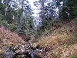
There is a creek that runs through the bottom of the valley I was in. It looks like you might be able to follow it to the road on the Chehalis side. But, I am not sure.

Thanks you putting that track on map otg. I didn't get very far. :(
 
O

old trials guy

Guest
imported post

imported post

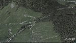
Here is a view looking to the west. You can see the old haul rode on the left hand side and it appears to switchback and continue up towards the area North hiked into today. Of course it is much more overgrown than google earth simulates however the gap is closing.

otg
 

Attachments

  • Oct 27 GE pic.jpg
    Oct 27 GE pic.jpg
    104.1 KB · Views: 0

North

Active member
imported post

imported post

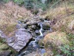
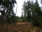
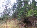
Here's some pictures from were I went off the road.

The bottom the valley
 

Attachments

  • toward chelalis.jpg
    toward chelalis.jpg
    115.4 KB · Views: 0

North

Active member
imported post

imported post

I shot of the stream continuing on.
 

Attachments

  • otherway.jpg
    otherway.jpg
    110.2 KB · Views: 0
Top