northwest connector found

G

Guest

Guest
imported post

imported post

old trials guy wrote:
The forecast for this Saturday sounds decent. I was thinking a ride up to Statlu to check out the back side of Flynn's route might be in order.If anyone is interested post up or PM. It won't be an early start.

otg
I'm gonna go out on a limb & say I'm in without checking to see if my better half has made any Saturdayplans for us :shoot: What time you figuring? I'd prefer not to start too late.
 

North

Active member
imported post

imported post

6fiddy wrote:
North wrote:
I might have this Thursday October 22 off work. So I am thinking that I might spend the dayhikingforthe connector if I do.

The weather calls for cloudy with showers.
Rickster, what time you figuring?

Right now I am still waiting to see if I have the day off, and the time would depend on how work goes tonight. But I would hope to leave my house around 9:00 ish in the morning.
 

North

Active member
imported post

imported post

Well, 6fiddy and I rode out to Sasquatch Inn and when along the Chehalis FSR to the Statlu Creek FSR and hooked up with the Track we got from otg. We rode around Statlu Landing trying to see if we could spot the Haul Road that might be the Connector.

We than followed otg's track along what I think is the Margaret Creek FSR to the Pass Road to Norrish Creek FSR and we came out on the Norrish Creek FSR to the Hawkin Pickle.

Going up one section was cross ditch city. I think it was the start of the Margaret Creek FSR when we turned off of Statlu Creek FSR on the way back.

We were not able to see the Haul Road that we were looking for.

It's going to take boots on the ground to find the Connector. A possible over-night rucksack expedition. The Haul Road can be seen from were the present Connector trail work has been done. It would be a hike through a new growth wooded valley to the Haul Road on the ridge. Than following the Haul Road to it's end. Which, should be above Statlu Landing.

Hopefully a person walking the Haul Road would find an overgrown spur that would connect to Sylvester FSR.

Whatever is found, the Exploring will be fun.

Rick
 

Attachments

  • end of the road 2.jpg
    end of the road 2.jpg
    65.7 KB · Views: 0
O

old trials guy

Guest
imported post

imported post

you got gps tracks from your trip today?


otg
 

North

Active member
imported post

imported post

Well, I thought I did, but I don't. :shock: But I do know on the map were were we went.


We hit the east side of your "track 3" from Sasquatch Inn. We rode it to it's north-western tip. And then we rode the on east side of the track, north to Norrish.
 
O

old trials guy

Guest
imported post

imported post

6fiddy wrote:
old trials guy wrote:
The forecast for this Saturday sounds decent. I was thinking a ride up to Statlu to check out the back side of Flynn's route might be in order.If anyone is interested post up or PM. It won't be an early start.

otg
I'm gonna go out on a limb & say I'm in without checking to see if my better half has made any Saturdayplans for us :shoot: What time you figuring? I'd prefer not to start too late.

Having read over North's trip report I am not sure where that leaves us. From what I understand, they couldn't find the haul road that would get us in the proximity of Flyn's route (the one we have been clearing). If that road doesn't exist then the alternative is to try and find a road that will get us close to the landing franhoser and I found on the Statlu side. There are several potential routes in the Lost Creek area and we haven't checked them all out yet. I think we should do some more exploring in that area to see if there is an easier route upto that pass.

Saturday morning calls for dry and sunny but it will be chilly. How about Bruce's at about 9 for breakfast and a ride out to Lost Creek for some further exploration???

All are welcome to join, if you have any suggestions on routes let's hear them. There could be some hiking involved :shock:.

otg
 
G

Guest

Guest
imported post

imported post

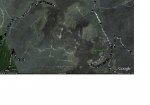
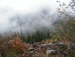
We could not find the yellow spur the leads to the 2 roads I have marked as 'unknown'. I don't know the name of the place from where I snapped this pic -- it was a landing at the end of one of the many FSR's out there. North might know what it's called. I believe the camera was pointing south-west for the shot but that is just a hunch.

We assumed the lowest green line was the road that lead us to where we were, & our plan was to simply go back & turn ontothe yellow spur then follow both 'unknown' roads to see where they go. Unfortunately we did not see the yellow spur. I dunno if we simply rode by & missed it,assumed it was another road, or maybe it's hidden behind some growth & hard to see. Hell, maybe we weren't even on the lowest green road -- who knows?!

The pic is too wide to post here. Here a link instead.
 
O

old trials guy

Guest
imported post

imported post

6fiddy wrote:
We could not find the yellow spur the leads to the 2 roads I have marked as 'unknown'. I don't know the name of the place from where I snapped this pic -- it was a landing at the end of one of the many FSR's out there. North might know what it's called. I believe the camera was pointing south-west for the shot but that is just a hunch.

We assumed the lowest green line was the road that lead us to where we were, & our plan was to simply go back & turn ontothe yellow spur then follow both 'unknown' roads to see where they go. Unfortunately we did not see the yellow spur. I dunno if we simply rode by & missed it,assumed it was another road, or maybe it's hidden behind some growth & hard to see. Hell, maybe we weren't even on the lowest green road -- who knows?!
Kinda like we can't see the forest for the trees.....:gaah:

If North could tell me where the picture was taken it might be helpful. Any more details on location would be good, mark it on a map, scan it and email to me if you can.

I wonder how our ancestors did it, crossing the country without GPS, digital cameras or the internet (or motorcycles for that matter)? Imagine finding the Rogers Pass with only a compass and inclinometer and doing it ON FOOT!!!!

otg
 

North

Active member
imported post

imported post

6fiddy wrote:
We could not find the yellow spur the leads to the 2 roads I have marked as 'unknown'. I don't know the name of the place from where I snapped this pic -- it was a landing at the end of one of the many FSR's out there. North might know what it's called. I believe the camera was pointing south-west for the shot but that is just a hunch.

We assumed the lowest green line was the road that lead us to where we were, & our plan was to simply go back & turn ontothe yellow spur then follow both 'unknown' roads to see where they go. Unfortunately we did not see the yellow spur. I dunno if we simply rode by & missed it,assumed it was another road, or maybe it's hidden behind some growth & hard to see. Hell, maybe we weren't even on the lowest green road -- who knows?!

The pic is too wide to post here. Here a link instead.

The picture was taken right below the last "e" of the the words "right here" at the end of the trail.

I don't think it was possible to see the haul road, it could be there. Thats why I think that we are going to have to hike a long it.

On the way down from were 6fiddy took the picture, he found an over grown road that had been blocked off.

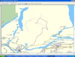
One thing I would like to get is a a full sized topo mao of the area to mark the roads on and to be able to tell where we are in reference to those roads. The whole area is honeycombed with roads we should be able to work out a Connector.
 

Attachments

  • 304Northwest_Connector_Overview2.jpg
    304Northwest_Connector_Overview2.jpg
    91.4 KB · Views: 0
O

old trials guy

Guest
imported post

imported post

My guess is the picture is actually looking to the North East (especially if one of the green lines was the road you came up. That kinda looks like the road coming up from Dickson Lake connecting to Statlu Creek FSR.

Another suggestion would be to try and hike up from that point over the ridge which should look down on Stave Lake side. There is a creek bed at the switchback and that might provide some direction for bushwacking up the hill.

otg
 
G

Guest

Guest
imported post

imported post

Rick, can you give me a location on this map as to where we stopped to take pics (the dead end)? The bottom right hand corner is where we started, right?

map01.jpg
 

North

Active member
imported post

imported post

I will print it out at work and see it I can.


The red is the route we took back, minus the spars we explored a bit.
 

Attachments

  • connectorwayback1.JPG
    connectorwayback1.JPG
    103.6 KB · Views: 0
G

Guest

Guest
imported post

imported post

old trials guy wrote:
Saturday morning calls for dry and sunny but it will be chilly. How about Bruce's at about 9 for breakfast and a ride out to Lost Creek for some further exploration???

All are welcome to join, if you have any suggestions on routes let's hear them. There could be some hiking involved :shock:.

otg
OTG are you still heading out tomorrow?
 
O

old trials guy

Guest
imported post

imported post

6fiddy wrote:
old trials guy wrote:
Saturday morning calls for dry and sunny but it will be chilly. How about Bruce's at about 9 for breakfast and a ride out to Lost Creek for some further exploration???

All are welcome to join, if you have any suggestions on routes let's hear them. There could be some hiking involved :shock:.

otg
OTG are you still heading out tomorrow?

Unless the weather turns out pouring rain, I plan on going. Either head up Norrish to Statlu and have another look for the haul road up to Flyn's trail or do some exploring in the Lost Creek area. (maybe both if time permits)

otg
 
G

Guest

Guest
imported post

imported post

Ok I can meet you at Bruce's at 9am or we can meet up before that since we're both in PoCo. What ya wanna do?
 

North

Active member
imported post

imported post

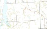
Here is were we ent on your map 6fiddy.

The red shows the roads we used on your map on the way in.

The green is the rest of the route that I just free handed in.


The blue is the road we turnedright onto on the way back.It was blocked by that big log. And had all those cross ditches onthe way up. I believe itto be the Margaret Creek Forest Service Road.
 

Attachments

  • map02.JPG
    map02.JPG
    73.7 KB · Views: 0

North

Active member
imported post

imported post

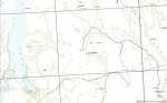
Here's the rest of the way back in light blue.
 

Attachments

  • map03.JPG
    map03.JPG
    75.8 KB · Views: 0
Top